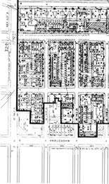
This walking tour map was designed with the desire to return a sense of appreciation and understanding to the Historic Harlem's Sugar Hill community. The northern border of the Sugar Hill community is 155th street. The southern border is 145th Street. The eastern border is Edgecombe Avenue and the western border touches Amsterdam Avenue.
Take the A, B, C or D trains to 145th Street Station. For Uptown travelers the exit will be at the rear of the train. For Downtown travelers, the exit will be at the front of the train. This walking tour begins at the intersection of 145th Street & Saint Nicholas Avenue and takes approximately 1hour 30 minutes to complete.
Sugar Hill stands out as an epicenter of cultural development in the African American experience. Sitting on a high point in the topography of Manhattan, Sugar Hill looks out onto the valley of Harlem to the east giving views beyond the Harlem River. During the Harlem Renaissance this area was revered as a spot that claimed and enjoyed the "sweet" life, thus the descriptive name Sugar Hill was given. Within the Sugar Hill boundaries you will find an adventure full of rich history. Allow yourself to be transported back in time when the dapper danz of Harlem glided down the wide avenues tipping their hats to the impeccably dressed dames.
Go struttin' in Duke Ellington's neighborhood where he wrote "Take the A train" or sit in on a session at St. Nick's Pub where Billy Holliday poured out her heart as she sang "Good Morning Heartache". Stroll past the residence of the tapping sensations the Nicholas Brothers, walk in the foot steps of Thurgood Marshall (1st African American Supreme Court Justice) or check out the former home of Circus Man James A. Bailey of Ringling Brothers, Barnum & Bailey fame.
As the Sugar Hill map winds you through this stately neighborhood feel the grandeur of early 20th century architecture by architects such as George Frederick Pelham, Henri Fouchaux and Samuel Burrage Reed. The individual expression in the detailed façades of their work balanced with a high level of continuity that ties the neighborhood together as a whole.
Keep in mind that in the early 20th Century much of Upper Manhattan had not yet been fully developed and thus residences in this area were considered relaxing getaways from the hustle and bustle of Lower Manhattan. Many of these Brownstones were originally built for single-family dwellings and boasted large living spaces, servant quarters and in some case small back yards.
Today in Sugar Hill there continues to be a slower tempo than one might experience in Lower Manhattan. Although Sugar Hill continues to change and grow with newly renovated Brownstones, the rise of new co-ops and the arrival of chain grocery stores it is considerably slower than along 125th Street. Sugar Hill continues to hold onto to its residential essence. One can still find children playing hopscotch on the sidewalk, block parties in the summer months and an occasional community garden being tended.
We hope that you will use this map as a tool to get to know the neighborhood and to contribute to the local economy by purchasing from the area vendors.
In an effort to give back to the community a portion of all profits from this map are donated to organizations that edify and preserve the Harlem experience.
This map concept was created and developed by Derek AGILE Jones.